MSSS DELIVERS HIGH-RESOLUTION MAPS OF THE MOON
Malin Space Science Systems (MSSS) of San Diego, CA, has completed a set of high-resolution digital maps of the Moon produced from images taken by the US Department of Defense/NASA Clementine Mission in 1994. These maps, which were assembled from several hundred thousand separate Clementine High Resolution (HiRes) camera images, have been delivered to NASA for distribution through the Planetary Data System. The production of the Clementine HiRes maps used machine vision software, developed by MSSS, that automatically located and correlated the vast majority of the images. This dataset, which fills 22 CD-ROMs, provides a factor five improvement in the detail that can be seen over significant sections of the lunar surface, and includes nearly complete coverage of the polar regions. It is an exciting new tool for lunar geology, and provides a context for interpreting other datasets such as the recent polar ice results from the Lunar Prospector Mission.
“Automated processing was the key to producing the HiRes dataset,” said Jeff Warren, MSSS lead on the Clementine HiRes Map effort. “It would have been impossible to mosaic these two hundred thousand images manually on anything approaching the timescale or cost we achieved with Clementine.”
The Clementine HiRes maps were produced by spatially registering each HiRes image to the photometrically-calibrated United States Geological Survey (USGS) digital basemaps issued in 1997. The USGS maps cover the entire Moon at a resolution of 100 to 150 meters per pixel using images from Clementine’s Ultraviolet/Visible camera. A total of 187,526 raw HiRes images were used in these mosaics: 86% for the sub-polar mosaics and 14% for the polar mosaics. Nearly twice this number of HiRes images were excluded from the maps because of poor exposure or camera pointing. The HiRes maps cover about 8% of the lunar surface at 20 to 30 meters per pixel resolution, which is five times higher resolution than the USGS basemap.
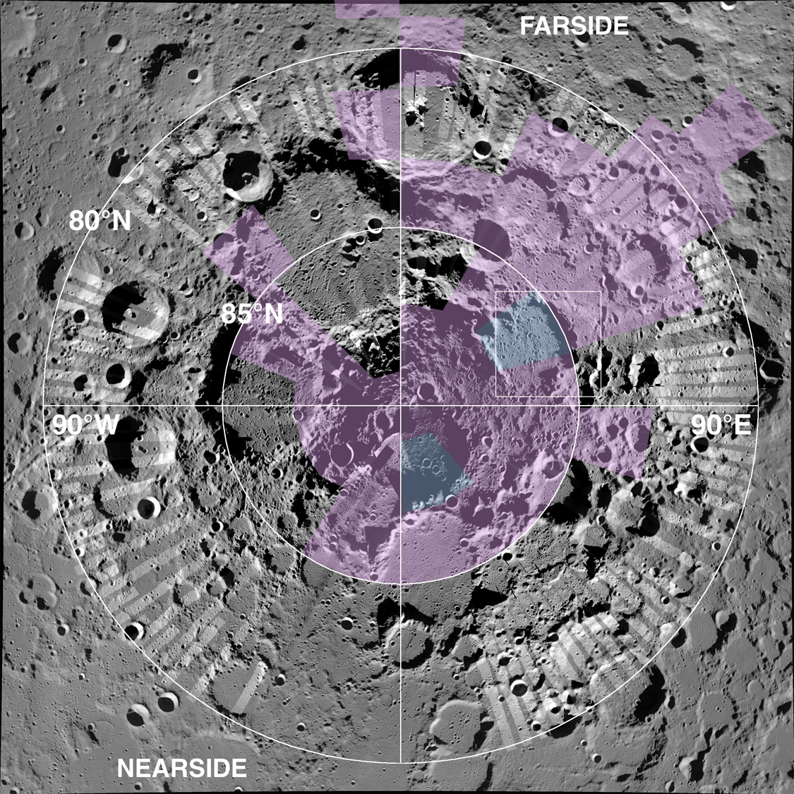
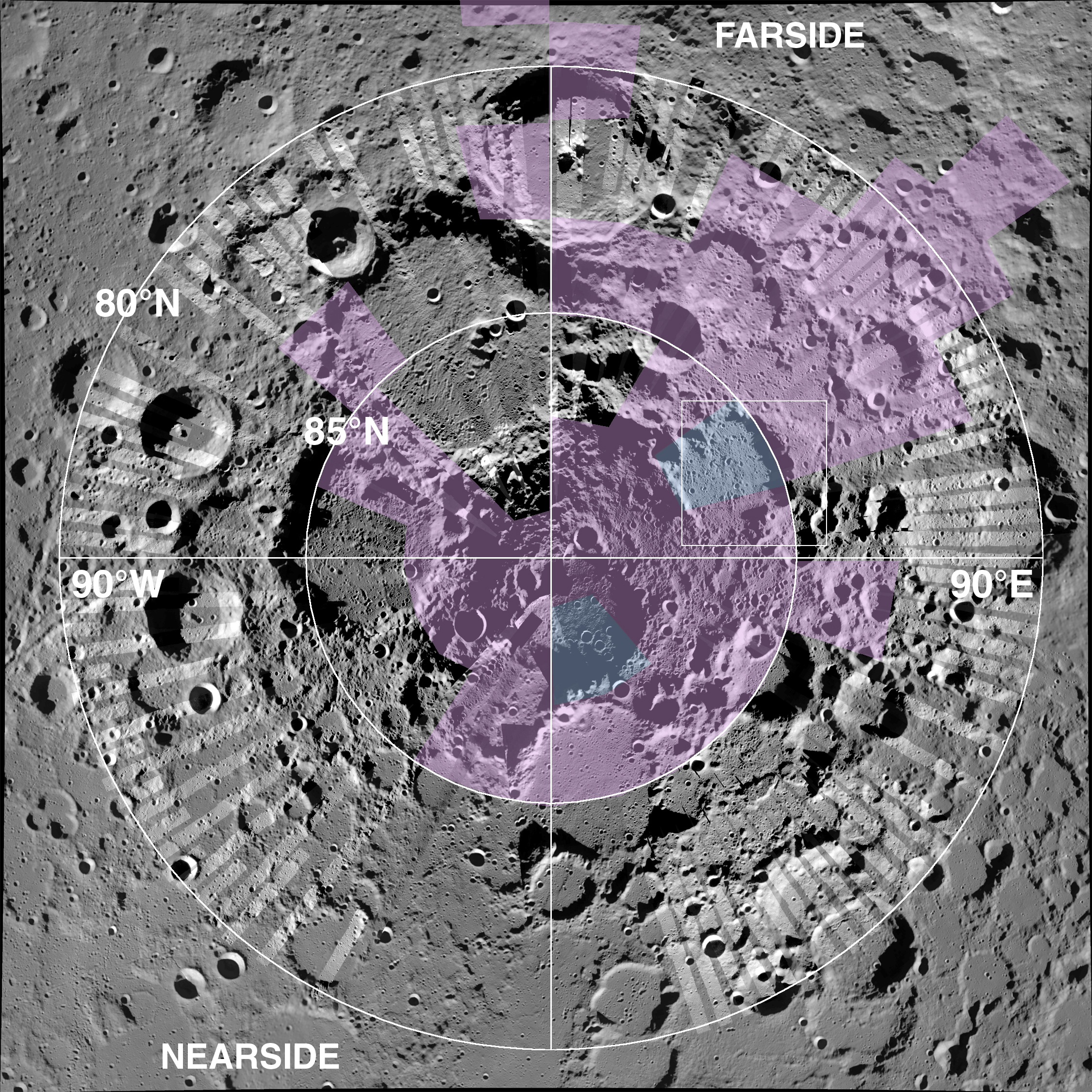
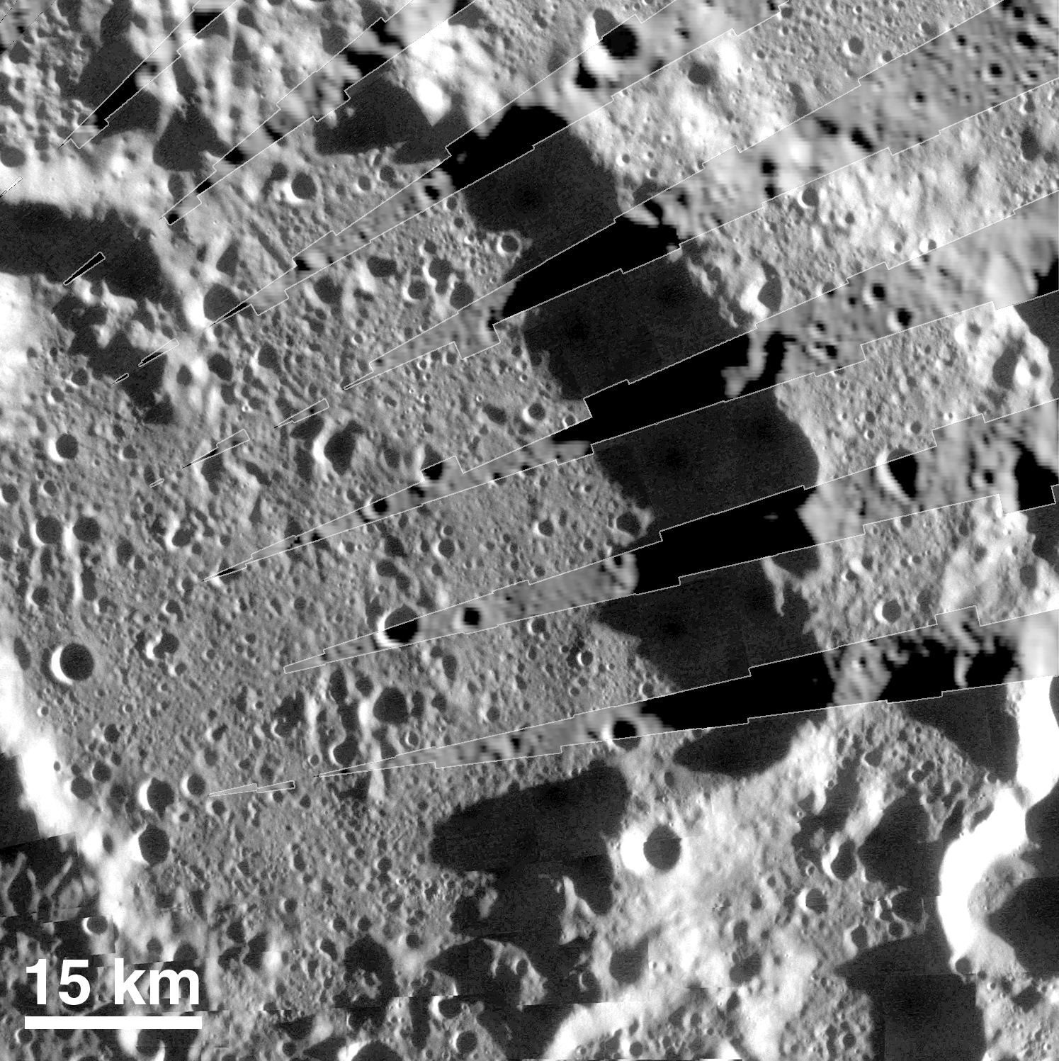
The HiRes map coverage near the poles is extensive, as is shown in the overlay of one of two HiRes maps on the USGS basemap of the north pole of the Moon (Figure 1). The colors in Figure 1 depict data from the Lunar Prospector Mission neutron spectrometer, showing areas where low neutron count indicates the presence of ice (see http://lunar.arc.nasa.gov/ for a presentation of those results). A more detailed view of the area in the white box in Figure 1 (Figure 2) shows the improvement in resolution provided by the HiRes map.
600 m/pixel version (1.1 MByte JPEG)
300 m/pixel version (3.4 MByte JPEG)
The basemap registration was semi-automated through procedures and software developed at MSSS. The automated portion employed image correlation (HiRes-to-basemap and HiRes-to-HiRes) followed by constrained location. The small fraction of HiRes images that were misplaced by this automated procedure, mainly because of basemap imperfections and lack of basemap detail, required manual registration. The individual HiRes images were also calibrated for image non-uniformity artifacts and approximate photometric response before being registered to the basemap.
120 m/pixel version (415 KByte JPEG)
60 m/pixel version (1.4 MByte JPEG)
The bulk of the CD-ROMS (18) covers the sub-polar regions below 80 degrees latitude at a scale of 20 meters/pixel in the sinusoidal map projection. The remaining 4 CDs cover the north and south poles with 30 meter/pixel scale in the stereographic map projection. Two CDs are devoted to each pole, one representing images acquired when the spacecraft was closest to the moon’s south pole, and the other when the spacecraft was closer to the north pole.